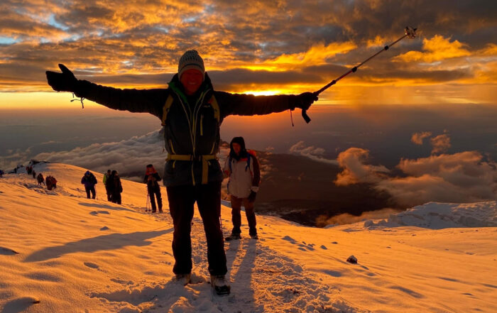
Watch the Sunrise Over Africa
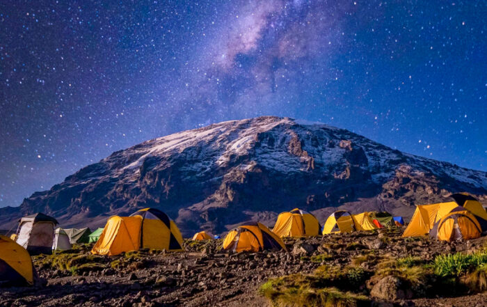
Accommodation: Hotel & tent
Fitness level: Able to hike 4-5 miles at a time
Summit Africa’s Highest Point!
Northern Circuit Route
The Kilimanjaro Northern Circuit Route is an unforgettable experience. This relatively new route ascends the more scenic and tranquil western slope of Kilimanjaro and crosses nearly the entire mountain before the summit. This is easily one of the most picturesque paths and peaceful journeys up Africa’s highest point, as there are almost no other groups on the northern face.


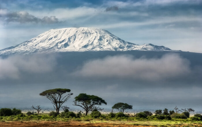
Mount Kilimanjaro
Mount Kilimanjaro is a dormant volcano in Tanzania. It has three volcanic cones: Kibo, Mawenzi, and Shira. It is the highest mountain in Africa and the highest single free-standing mountain above sea level in the world: 5,895 metres above sea level and about 4,900 metres above its plateau base.
Tour Overview
Price
$2,970 USD
Departure time
8:00 am
Meeting point
We’ll pick you up at Kilimanjaro International Airport and then transfer you to your hotel in Moshi, Tanzania. You will then stay overnight and in the morning, we’ll drive to the gate where we will start our Kilimanjaro trek. Please note: the hotel and transfers are included in the price.
Availability
January through mid-March
Mid-June through October
December
Duration
9 days, 8 nights + 2 days at hotel
Tour Itinerary
- Elevation: 2,100m/6,890ft to 2,850m/9,350ft
- Distance: 6 km/4 miles
- Hiking time: 3-4 hrs
- Habitat: Rain forest
After breakfast at the hotel, we’ll make our way to the western side of Kilimanjaro, to the Londorossi Gate, where we will meet up with our team of porters and guides. After we register your climb, our staff will prepare the supplies and gear for our trek. Here we can rest and take pictures while we wait for our baggage to be weighed and for the other necessary trip formalities to be completed.
We’ll then begin the climb. The trail gently ascends through the mountain forest and towards the end of the trek, we’ll enter the first camp that will have been set up and waiting for us. Tonight, we’ll rest under the forest canopy listening to the sounds of birds and velvet monkeys calling gently to each other—a very special experience.
- Elevation: 2,850m/9,350ft to 3,505m/11,500ft
- Distance: 8 km/5 miles
- Hiking time: 5-6 hrs
- Habitat: Moorland/heath
We leave the rainforest, entering the heath and moorland zone. Today, we have amazing panoramic views that reach the rim of the Shira Plateau and enjoy the stunning views from the ridge. This day may challenge your body’s acclimatization but you’ll be in good hands and we’ll be taking short, continuous breaks. We will then camp on the Shira Plateau.
- Elevation: 3,500m/11,500ft to 3,840m/12,600ft
- Distance: 7 km/4 miles
- Hiking time: 3-4 hrs
- Habitat: Moorland
This is a short day in terms of terrain and elevation. We’ll look to climb about 350m/1,148ft of gentle hiking. We’ll treat this as a resetting and acclimatization day and a chance to explore the Shira Plateau whilst enjoying views of Kibo, the largest of the three volcanic cones on Kilimanjaro.
- Elevation: 3,840m/11,400ft to 4,600m/15,150ft to 4,200m/13,700ft
- Distance: 12 km/7 miles
- Hiking time: 5 hrs up/3 hrs down
- Habitat: Moorland/alpine desert
This is a very important day in your growth and in your progression up the mountain. An imperative day for acclimatization. Once we arrive at the Lava Tower you will be served lunch, rest, and then descend down to Moir Hut, where we divert from the main trail.
- Elevation: 4,200m/13,700ft to 4,000m/13,100ft
- Distance: 12 km/7 miles
- Hiking time: 5-6 hrs
- Habitat: Semi-alpine desert/moorland
We leave Moir by starting with a bit of a steep climb. We’ll then follow the trail that crosses a rock field up and then down. We’ll treat this as a recovery day, as we actually descend to 4,000m/13,100ft to Buffalo Camp where we will be served a delicious hot lunch.
- Elevation: 4,000m/13,100ft to 3,800m/12,500ft
- Distance: 5 km/3 miles
- Hiking time: 3-4 hrs
- Habitat: Moorland/heath
Our day begins with a trek around the northern slopes heading towards the eastern side of the mountain. The terrain here is dry with a bit of dust and a few shrubs. The route is quiet and we won’t come across very many other groups. On this day, we’ll begin to catch a sense of the quiet serenity and remoteness during our trek before we reach the Third Cave Camp.
- Elevation: 3,800m/12,500ft to 4,800m/15,750ft
- Distance: 7 km/4 miles
- Hiking time: 4-5 hrs
- Habitat: Moorland/alpine desert
This part is a steady ascent before we reach the School Hut. We’ll see some incredible views of the saddled landscape between Kibo Peak and Mawenzi Peak. You will enjoy lunch at the School Hut and then we’ll rest and finish preparing for the summit attempt.
- Elevation: 4,800m/15,750ft to 5,895m/19,635ft
- Distance: 6km/3 miles up and 10km/6 miles down
- Hiking time: 10-11 hrs
- Habitat: Moorland
We begin our summit push at midnight after being woken up with a hot cup of tea, a biscuit, and a snack for your way up. We’ll start the summit push by zigzagging from Hans Mayer Cave, where we will take a rest for snacks, and continue to Gilman’s Point. This will take roughly 2 hours and is a steep climb with loose terrain underfoot. We’ll be walking at quite a slow pace as it will be cold and possibly windy too. As we approach the crater rim, the sun will begin rising behind you and next to the Mawenzi Peak. Remember, as the sun rises, it brings warmth, and when you feel the heat, it will create an inner fire that will boost your energy and motivate you to keep ploughing forward.
At Gilman’s Point, we’ll enjoy a well-deserved rest and a snack before continuing to Uhuru Peak. You’ll be able to take some pictures at Uhuru Peak and enjoy the incredible views before we descend to Barafu Camp and have lunch. We will then gently walk down to Millennium Camp.
- Elevation: 3,900m/12,800ft
- Distance: 14 km/8 miles
- Hiking time: 5-6 hrs
- Habitat: Moorland/rain forest
We’ll finish our magnificent trek through lush forest as we descend to the Mweka Gate. This sustained descent will become easier by having colobus/blue monkeys and melodic birdsong cheering us on. At the gate, we will then sign out of the national park as we collect our summit certificate and on through a coffee farm where we are then transferred back to Moshi.
Highlights
What Sets This Route Apart
- Spectacular scenery through various habitats
- Sweeping vistas of Mt. Kilimanjaro from the western slope looking out toward Mt. Meru and Moshi Town
- An extra day to acclimatize (climb high, sleep low is what they say!)
- An unforgettable summit sunrise
- A less crowded route with a high success rate (around 95% of climbers summit)
Price Includes
- Dedicated Customer Satisfaction Associate
- Airport pick-up and drop-off
- Hotel lodging the night before and the night after the climb
- Breakfast before and after the climb
- All meals and water on the mountain
- All park fees and taxes
- Transportation to and from the hotel and trailhead
- Tents (3-person mountaineering tent)
- Sleeping mat
- Private toilet tent
- Support team (certified guides, porters, and cooks)
- Kilimanjaro SAR evacuation insurance
Price Includes
-
- Airfare to and from Tanzania
- Personal travel insurance
- Visa
- Tips for the support team
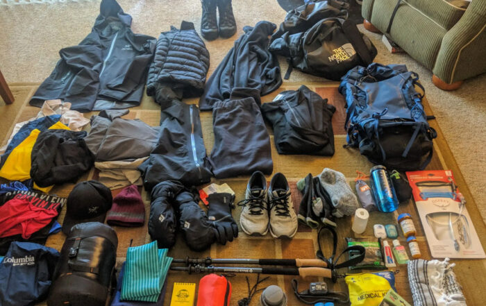
- Sleeping bags and other personal gear
- Rental gear
- Lunch and dinner at the hotel
- Drinks and snacks
Book The 9-Day Northern Circuit Route
Please note: After your purchase is confirmed we will email you a confirmation.
Read More About Kilimanjaro Climbing
Tour Overview
Price
$2,610 USD
Departure time
8:00 am
Meeting point
We’ll pick you up at Kilimanjaro International Airport and then transfer you to your hotel in Moshi, Tanzania. You will then stay overnight and in the morning, we’ll drive to the gate where we will start our Kilimanjaro trek. Please note: the hotel and transfers are included in the price.
Availability
January through mid-March
Mid-June through October
December
Duration
8 days, 7 nights + 2 days at hotel
Tour Itinerary
- Elevation: 2,460m/7,742ft to 2,895m/9,498ft
- Distance: 6 km/4 miles
- Hiking time: 3-4 hrs
- Habitat: Rain forest
We depart Moshi for Londorossi Gate, roughly a 4-hour drive, where you will complete the entry formalities. We will then drive to the Lemosho trailhead and upon arrival, we will begin the hike through undisturbed forest which winds its way to the first campsite. Keep your eyes peeled for the blue monkeys swinging through the trees!
- Elevation: 2,895m/9,498ft to 3,505m/11,500ft
- Distance: 8 km/5 miles
- Hiking time: 5-6 hrs
- Habitat: Heath
We continue on the trail leading out of the rainforest and into a savannah of tall grasses, heather, and volcanic rock draped with lichen beards. As we ascend through the lush rolling hills and cross several streams, we reach the Shira Ridge before dropping gently down to Shira 1 Camp. Here we catch our first glimpse of Kibo across the plateau.
- Elevation: 3,505m/11,500ft to 4,206m/13,800ft
-
Distance: 11 km/7 miles
-
Hiking time: 5-7 hrs
-
Habitat: Heath
Today, we will spend the full day exploring the Shira Plateau, one of the highest plateaus on earth. It is a gentle walk east on moorland meadows towards Shira 2 Camp. We then divert from the main trail to Moir Hut, a lesser-used camping site at the base of the Lent Hills. A variety of walks are available on Lent Hills making this an excellent acclimatization opportunity.
Moir Hut to Lava Tower
- Elevation: 4,206m/13,800ft to 4,629m/15,190ft
- Distance: 7 km/4 miles
- Hiking time: 4-5 hrs
- Habitat: Alpine desert
Lava Tower to Barranco Camp
- Elevation: 4,629m/15,190ft to 3,963m/13,044ft
- Distance: 3 km/2 miles
- Hiking time: 2-3 hrs
- Habitat: Alpine desert
We begin the day climbing up a ridge and then head southeast towards the Lava Tower – a 300 ft tall volcanic rock formation. We descend down to Barranco Camp through the strange but beautiful Senecio Forest to an altitude of 13,000 ft. Although you begin and end the day at the same elevation, the time spent at higher altitude is extremely beneficial for acclimatization.
- Elevation: 3,963m/13,044ft to 3,994m/3,106ft
- Distance: 5 km/3 miles
- Hiking time: 4-5 hrs
- Habitat: Alpine desert
We begin the day by descending into a ravine to the base of the Great Barranco Wall. We will then climb the non-technical but steep, nearly 900ft, cliff. The Barranco Wall, also known as the Kissing Wall, is approximately 3 ft. wide. This narrow section is famous because climbers often place a kiss on the rock as they pass by. Climbers also “hug” the outcrop and breathe a sigh of relief on the other side as they realize it wasn’t nearly as intimidating as it looked.
From the top of the Barranco Wall, we cross a series of hills and valleys until we descend sharply into Karanga Valley. One more steep climb up leads us to Karanga Camp. This shorter day will prepare us for higher elevation at the summit.
- Elevation: 3,994m/3,106ft to 4,672m/15,331ft
- Distance: 4 km/2 miles
- Hiking time: 4-5 hrs
- Habitat: Alpine desert
We leave Karanga and hit the junction which connects with the Mweka Trail. We continue up the rocky section to Barafu Hut. At this point, you have completed the Southern Circuit, which offers views of the summit from many different angles. Here we make camp, rest, and enjoy an early dinner to prepare for the summit day. The two peaks of Mawenzi and Kibo are visible from this position.
Barafu Camp to Uhuru Peak
- Elevation: 4,672m/15,331ft to 5,895m/19,341ft
- Distance: 5 km/3 miles
- Hiking time: 7-8 hrs
- Habitat: Arctic
Uhuru Peak to Mweka Camp
- Elevation: 5,895m/19,341ft to 3,067m/10,065ft
- Distance: 12 km/7 miles
- Hiking time: 4-6 hrs
- Habitat: Rain forest
Very early in the morning (around midnight), we begin our push to the summit. This is the most mentally and physically challenging part of the trek. At this elevation and time of day, the wind and cold can be extreme. We ascend in the darkness for several hours while taking frequent but short breaks. Near Stella Point (18,900ft), you will be rewarded with the most magnificent sunrise you are ever likely to see coming over Mawenzi Peak.
Finally, we arrive at Uhuru Peak— the highest point on Mount Kilimanjaro and the continent of Africa. Here, you can take a moment to reflect on your tremendous accomplishment. You’ll obviously have the opportunity to take a few pictures from the ‘Rooftop of Africa’ to memorialize this special moment.
From the summit, we now make our descent continuing straight down to the Mweka Hut campsite, stopping at Barafu for lunch. The trail is very rocky and can be quite hard on the knees; trekking poles are helpful. Mweka Camp is situated in the upper forest and mist or rain can be expected in the late afternoon. Later in the evening, we will enjoy our last dinner on the mountain and a well-earned sleep.
- Elevation: 3,067m/10,065ft to 1,639m/5,380ft
- Distance: 10 km/6 miles
- Hiking time: 3-4 hrs
- Habitat: Rain forest
On our last day, we continue the descent to Mweka Gate where we will be met by our driver who will transport us back to the hotel in Moshi. Here, we can relax with some refreshments, perhaps a local Kilimanjaro beer, while we wait to receive our summit certificates. At lower elevations, it can be wet and muddy. From the gate, we continue another hour to Mweka Village. A vehicle will meet us at Mweka Village to drive us back to the hotel in Moshi.
Highlights
What Sets This Route Apart
- Spectacular scenery through various habitats
- Sweeping vistas of Mt. Kilimanjaro from the western slope looking out toward Mt. Meru and Moshi Town
- An extra day to acclimatize (climb high, sleep low is what they say!)
- An unforgettable summit sunrise
- A less crowded route with a high success rate (around 95% of climbers summit)
Price Includes
- Dedicated Customer Satisfaction Associate
- Airport pick-up and drop-off
- Hotel lodging the night before and the night after the climb
- Breakfast before and after the climb
- All meals and water on the mountain
- All park fees and taxes
- Transportation to and from the hotel and trailhead
- Tents (3-person mountaineering tent)
- Sleeping mat
- Private toilet tent
- Support team (certified guides, porters, and cooks)
- Kilimanjaro SAR evacuation insurance
Price Includes
-
- Airfare to and from Tanzania
- Personal travel insurance
- Visa
- Tips for the support team
- Sleeping bags and other personal gear
- Rental gear
- Lunch and dinner at the hotel
- Drinks and snacks